Array
(
[0] => Array
(
[name] => {:en}Bisanakandi{:}{:bn}বিছানাকান্দি{:}
[post_id] => 7828
[post_link] => http://offroadbangladesh.com/bn/places/bisanakandi/
[thumb_link] => http://offroadbangladesh.com/wp-content/uploads/2015/04/10410793_10205865808218505_7613722895639363442_n-300x188.jpg
[post_content] => {:en}
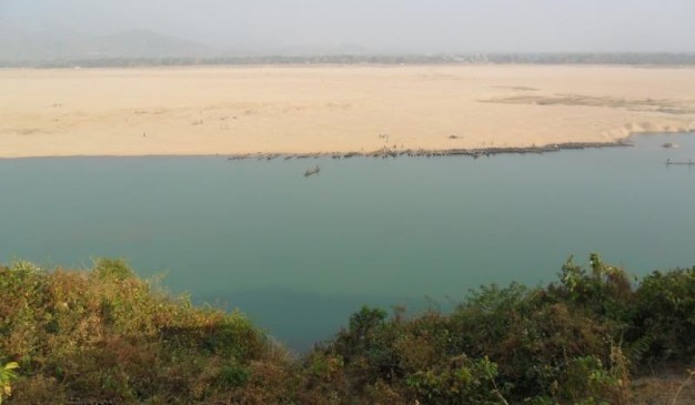
Bisanakandi is situated at Bangladesh-India border in Sylhet. It is a landscape beauty among gardens and hills. Bichanakandi is a village situated in Rustompur Union under Guainghat Upazilla. This is where many layers of the Khasi mountain meet at a single point from both sides. Flowing from above is a high fall. Adding to its charm are dark clouds hugging the mountain in the rainy season. And flowing underneath towards Bholaganj is a branch of the Piyain. Along the stream flowing from high up in the mountain come huge boulders that are deposited and mined in Bisanakandi.
Much like Jaflong, Bichnakandi is mostly a quarry. Winter is not a suitable time to visit Bisnakandi due to mechanized mining and stone-laden boats and lorries. The absence of such nuisance makes the rainy season the perfect time to visit the beautiful Bisanakandi that coalesces the charms of high mountains, sinuous rivers, graceful falls and dancing clouds.
Source:
Visit Sylhet{:}{:bn}
সিলেটের গোয়াইনঘাট উপজেলার রুস্তম ইউনিয়নে বাংলাদেশ-ভারত সীমান্তে অবস্থিত একটি গ্রামের নাম বিছানাকান্দি। বাগান এবং পাহাড়ের নজরকাড়া সৌন্দর্যের মাঝে অবস্থিত প্রকৃতির এই অপরূপ লীলাভূমির উভয় প্রান্ত থেকে খাসি পাহাড় এসে যুক্ত হয়েছে। এখানে ঝর্ণার পাশাপাশি বর্ষাকালে কালো মেঘ পাহাড়গুলোকে আচ্ছাদিত করে ফেলে। এছাড়া এখানে ভোলাগঞ্জ অভিমুখে বয়ে গিয়েছে পিইয়াইন নদীর একটি শাখা। পাহাড়ি ঢলের সাথে বয়ে আসা বিশাল পাথরখণ্ডগুলো বিছানাকান্দিতে এসে পড়ে এবং পরবর্তীতে এই পাথরখণ্ডগুলোকে এখানেই ভাঙ্গা হয়।
জাফলং এর মত বিছানাকান্দিও একটি খনি এলাকা। পাথর বোঝাই নৌকা, ট্রাকের আনাগোনা এবং পাথর উত্তোলনের কারনে শীতকাল বিছানাকান্দিতে আসার জন্য একেবারেই উপযুক্ত সময় নয়। তবে, বর্ষাকালে এখানে পাথর উত্তোলনের ফলে সৃষ্ট দূষণ না থাকায় আপনি এখানে এসে উঁচু পাহাড়, শান্ত নদী, মায়াবি ঝর্ণার সৌন্দর্যের পাশাপাশি রোদ ও মেঘের লুকোচুরি উপভোগ করতে পারবেন।
{:}
)
[1] => Array
(
[name] => {:en}Dholai River{:}{:bn}ধলাই নদী{:}
[post_id] => 9048
[post_link] => http://offroadbangladesh.com/bn/places/dholai-river/
[thumb_link] => http://offroadbangladesh.com/wp-content/uploads/2015/05/Dholai-Nodi-Bholagonj-11-300x225.jpg
[post_content] => {:en}
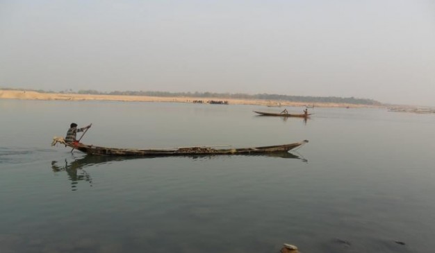
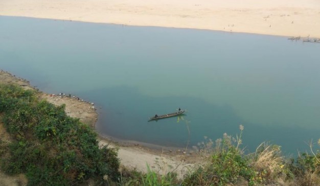
Dholai River is originated from the Cherapunji Hills (চেরাপুঞ্জি পাহাড়) of India and entered the country through the Bholagonj of Sylhet. After flowing very poorly in our country, it joined with the River Surma.
Dholai River (ধলাই নদী) is famous for the stones. People used to collect the stone from the river. I have walked at the bank of the river from Bholagonj to “dosh number point”. The river bank seems too high for me. Possibly during rainy season, the river may have lot of water with heavy current.
[This spot needs more detail. If you have more information and photos, please be advised to add in our website. Your name will be published as a Content Contributor]
{:}{:bn}
ধলাই নদী ভারতের চেরাপুঞ্জি পাহাড়ে উৎপত্তি হয়ে সিলেটের ভোলাগঞ্জ দিয়ে বাংলাদেশে প্রবেশ করেছে। বাংলাদেশের অভ্যন্তরে সল্প মাত্রায় প্রবাহিত হয়ে এই নদীটি সুরমা নদীর সাথে মিলিত হয়েছে।
পাথরের জন্য ধলাই নদীর খ্যাতি রয়েছে। মানুষজন একসময় এই নদী থেকে পাথর সংগ্রহ করতো। ভোলাগঞ্জ থেকে ‘দশ নং পয়েন্ট’ পর্যন্ত আপনি ধলাই নদীর পাড় ঘেঁষে হাঁটতে পারবেন। হাঁটার সময় নদীটির পাড় আপনার কাছে বেশ উঁচু মনে হতে পারে। বর্ষাকালে পানি বেড়ে যাওয়ায় ধলাই নদীর সৌন্দর্য পূর্ণমাত্রা অর্জন করে।
{:}
)
[2] => Array
(
[name] => {:en}Jaflong{:}{:bn}জাফলং{:}
[post_id] => 4142
[post_link] => http://offroadbangladesh.com/bn/places/jaflong/
[thumb_link] => http://offroadbangladesh.com/wp-content/uploads/2015/03/800-Jaflong_Sylhet_Shahnoor-Habib-Munmun1-300x225.jpg
[post_content] => {:en}
Jaflong is a union situated at Bangladesh-India border. Jaflong is a landscape beauty among gardens and hills. It is situated next to the river Peain round Hill Khashia. The Mari River originating from the great Himalayas brings tons of stone slabs with its stream. It’s a hilly area comprising of green forests.
Jaflong is a hill station and popular tourist destination in the Division of Sylhet, Bangladesh. It is located in Gowainghat Upazila of Sylhet District and situated at the border between Bangladesh and the Indian state of Meghalaya, overshadowed by subtropical mountains and rainforests. Jaflong is famous for its stone collections and is home of the Khasi (also known as Khasia) tribe.
Jaflong is one of the most attractive tourist spots in Sylhet division. It is about 60 km from Sylhet town and takes two hours drive to reach there. Jaflong is also a scenic spot nearby amidst tea gardens and rare beauty of rolling stones from hills. It is situated besides the river Mari in the lap of Hill Khashia.
{:}{:bn}
বাংলাদেশ-ভারতের সীমান্তবর্তী খাসিয়া পাহাড়ের কোলে মারি নদীর পাশে অবস্থিত পাহাড়, সবুজ বন ও বাগানের সৌন্দর্য ঘেরা একটি পাহাড়ি অঞ্চলের নাম জাফলং। হিমালয় থেকে সৃষ্ট মারি নদী এখানে প্রচুর পরিমানে পাথরখণ্ড বয়ে নিয়ে আসে।
জাফলং হল সিলেট বিভাগের একটি হিল স্টেশন এবং অন্যতম আকর্ষণীয় পর্যটন কেন্দ্র। সিলেট শহর থেকে ৬০ কিলোমিটার দূরে অবস্থিত এই পর্যটন কেন্দ্রে সড়কপথে পৌছাতে প্রায় দুই ঘণ্টা সময় লাগে। পাথর সংগ্রহ করা এবং আদিবাসী খাসিয়া সম্প্রদায়ের বসবাস এই দুটি কারনে জাফলং এর খ্যাতি রয়েছে। চা বাগান এবং পাহাড় থেকে গড়িয়ে আসা পাথরের বিরল সৌন্দর্যের দেখা মিলবে এখানে।
{:}
)
[3] => Array
(
[name] => Karnafuli River and Zoom Restaurant
[post_id] => 7023
[post_link] => http://offroadbangladesh.com/bn/places/karnafuli-river-and-zoom-restaurant/
[thumb_link] => http://offroadbangladesh.com/wp-content/uploads/2015/04/River-Karnafuli-and-zoom-restaurant3-300x240.jpg
[post_content] =>
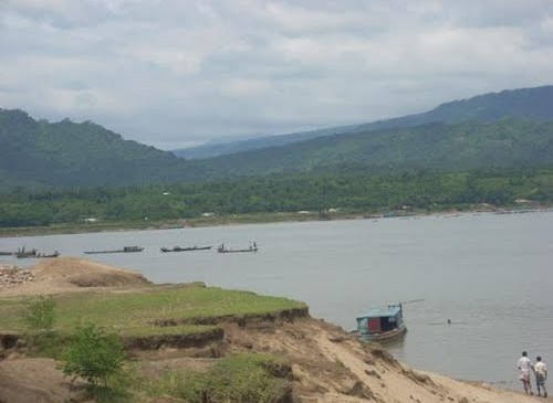
There are lots of marvelous natural and man-made objects to enjoy near the bank of Karnafuli River in the port city Chittagong. If you visit the Karnafuli River, there is a restaurant called Zoom, just beside the Chittagong-Kaptai road. This restaurant is monitored and managed by BDR. It’s a nice picnic spot. A lot of students from Rangamati go there as a study tour.
From the spot, you can enjoy the panoramic view over the river Karnafuli. This river is flowing nicely, always full with water, whether its dry season or rainy. Both side of the river has small Mountains, and which is rich with various kinds of deciduous trees. If you visit there in the dry season, you may find most of the trees having no leaves. Its different kinds of beauty. No sign of life, but it’s still wonderful to enjoy.
There are several boats at the river, you can have a boat ride using them. Those are a bit costly, but you know you have to spend some money when you want to enjoy that kind of such beauty.
)
)