Array
(
[0] => Array
(
[name] => {:en}Kongsha Nodi{:}{:bn}কংস নদী{:}
[post_id] => 5192
[post_link] => http://offroadbangladesh.com/bn/places/kongsha-nodi/
[thumb_link] => http://offroadbangladesh.com/wp-content/uploads/2015/03/Kongsho-nodi-Arif-Hasan1-300x225.jpg
[post_content] => {:en}
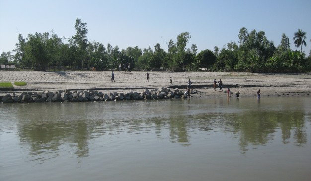
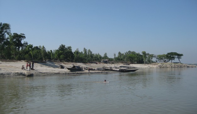
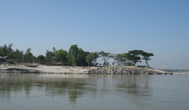
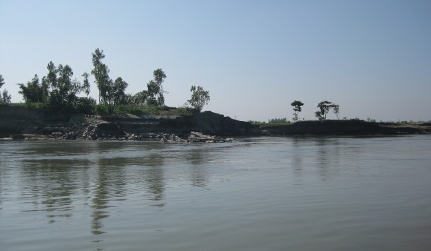
Kangsha (কংস), a river from Bangladesh (বাংলাদেশ). It has several names, Kangsha (কংস), Kangshai (কংসাই), Kangshabati (কংসবতী), etc. This flows through Mymensingh (ময়মনসিংহ) and Netrakona (নেত্রকোনা). All of the photos of this river were taken from Netrakona (নেত্রকোনা).
The river is originated from the Garo Hills (গারো পাহাড়) of India and flows as Kongsho (কংস), and later joined with the Shomeswari (সোমেশ্বরী) river at Jaria-Jhanjail (জারিয়া-ঝান্জাইল). The river kept the name Kangsha (কংস) after joining together.
Near the bridge you'll find two bazaar at either side. One is Jaria (জারিয়া), and other one is Jhanjail (ঝান্জাইল). People used to call this place as Jaria-Jhanjail (জারিয়া-ঝান্জাইল) together.
During its course the river become too narrow and before demising it has joined with another great river of Bangladesh, Shurma (সুরমা), at Sunamganj (সুনামগঞ্জ).
All the photos of this article were taken from the car while crossing the Kongsho Bridge at Jaria-Jhanjail. GPS coordinate of the bridge at (25° 0'46.59"N, 90°38'50.00"E)
{:}{:bn}
বাংলাদেশের অন্যতম এই নদীটির বিভিন্ন নাম রয়েছে যেমনঃ কংস, কংসাই, কংসবতী ইত্যাদি। ময়মনসিংহ এবং নেত্রকোনা জেলার মধ্যে দিয়ে এই নদীটি বয়ে গিয়েছে। ভারতের গারো পাহাড় থেকে উৎপত্তি হয়ে এই নদীটি কংস নামে বাংলাদেশে প্রবেশ করেছে এবং জারিয়াঝানজাইল নামক স্থানে সোমেশ্বরী নদীর সাথে মিলিত হয়েছে। সোমেশ্বরী নদীর সাথে মিলিত হবার পর নদীটির নাম কংসই রয়েছে।
কংস সেতুর কাছে নদীর উভয় প্রান্তে দুটি বাজার রয়েছে। একটি বাজারের নাম জারিয়া এবং অপরটির নাম ঝানজাইল। স্থানীয়রা এই জায়গাটিকে জারিয়া ঝানজাইল নামে বলে আসছে। ধীরে ধীরে নদীটির চলার পথ সরু হয়ে এসেছে এবং সুনামগঞ্জে এই নদীটি বাংলাদেশের অন্যতম নদী সুরমার সাথে মিলিত হয়েছে।
জিপিএস এ কংস নদীর অবস্থান হল (২৫°০'৪৬.৫৯"উ, ৯০°৩৮'৫০.০০"পু)
{:}
)
[1] => Array
(
[name] => {:en}Bisanakandi{:}{:bn}বিছানাকান্দি{:}
[post_id] => 7828
[post_link] => http://offroadbangladesh.com/bn/places/bisanakandi/
[thumb_link] => http://offroadbangladesh.com/wp-content/uploads/2015/04/10410793_10205865808218505_7613722895639363442_n-300x188.jpg
[post_content] => {:en}
Bisanakandi is situated at Bangladesh-India border in Sylhet. It is a landscape beauty among gardens and hills. Bichanakandi is a village situated in Rustompur Union under Guainghat Upazilla. This is where many layers of the Khasi mountain meet at a single point from both sides. Flowing from above is a high fall. Adding to its charm are dark clouds hugging the mountain in the rainy season. And flowing underneath towards Bholaganj is a branch of the Piyain. Along the stream flowing from high up in the mountain come huge boulders that are deposited and mined in Bisanakandi.
Much like Jaflong, Bichnakandi is mostly a quarry. Winter is not a suitable time to visit Bisnakandi due to mechanized mining and stone-laden boats and lorries. The absence of such nuisance makes the rainy season the perfect time to visit the beautiful Bisanakandi that coalesces the charms of high mountains, sinuous rivers, graceful falls and dancing clouds.
Source:
Visit Sylhet{:}{:bn}
সিলেটের গোয়াইনঘাট উপজেলার রুস্তম ইউনিয়নে বাংলাদেশ-ভারত সীমান্তে অবস্থিত একটি গ্রামের নাম বিছানাকান্দি। বাগান এবং পাহাড়ের নজরকাড়া সৌন্দর্যের মাঝে অবস্থিত প্রকৃতির এই অপরূপ লীলাভূমির উভয় প্রান্ত থেকে খাসি পাহাড় এসে যুক্ত হয়েছে। এখানে ঝর্ণার পাশাপাশি বর্ষাকালে কালো মেঘ পাহাড়গুলোকে আচ্ছাদিত করে ফেলে। এছাড়া এখানে ভোলাগঞ্জ অভিমুখে বয়ে গিয়েছে পিইয়াইন নদীর একটি শাখা। পাহাড়ি ঢলের সাথে বয়ে আসা বিশাল পাথরখণ্ডগুলো বিছানাকান্দিতে এসে পড়ে এবং পরবর্তীতে এই পাথরখণ্ডগুলোকে এখানেই ভাঙ্গা হয়।
জাফলং এর মত বিছানাকান্দিও একটি খনি এলাকা। পাথর বোঝাই নৌকা, ট্রাকের আনাগোনা এবং পাথর উত্তোলনের কারনে শীতকাল বিছানাকান্দিতে আসার জন্য একেবারেই উপযুক্ত সময় নয়। তবে, বর্ষাকালে এখানে পাথর উত্তোলনের ফলে সৃষ্ট দূষণ না থাকায় আপনি এখানে এসে উঁচু পাহাড়, শান্ত নদী, মায়াবি ঝর্ণার সৌন্দর্যের পাশাপাশি রোদ ও মেঘের লুকোচুরি উপভোগ করতে পারবেন।
{:}
)
[2] => Array
(
[name] => {:en}Dholai River{:}{:bn}ধলাই নদী{:}
[post_id] => 9048
[post_link] => http://offroadbangladesh.com/bn/places/dholai-river/
[thumb_link] => http://offroadbangladesh.com/wp-content/uploads/2015/05/Dholai-Nodi-Bholagonj-11-300x225.jpg
[post_content] => {:en}
Dholai River is originated from the Cherapunji Hills (চেরাপুঞ্জি পাহাড়) of India and entered the country through the Bholagonj of Sylhet. After flowing very poorly in our country, it joined with the River Surma.
Dholai River (ধলাই নদী) is famous for the stones. People used to collect the stone from the river. I have walked at the bank of the river from Bholagonj to “dosh number point”. The river bank seems too high for me. Possibly during rainy season, the river may have lot of water with heavy current.
[This spot needs more detail. If you have more information and photos, please be advised to add in our website. Your name will be published as a Content Contributor]
{:}{:bn}
ধলাই নদী ভারতের চেরাপুঞ্জি পাহাড়ে উৎপত্তি হয়ে সিলেটের ভোলাগঞ্জ দিয়ে বাংলাদেশে প্রবেশ করেছে। বাংলাদেশের অভ্যন্তরে সল্প মাত্রায় প্রবাহিত হয়ে এই নদীটি সুরমা নদীর সাথে মিলিত হয়েছে।
পাথরের জন্য ধলাই নদীর খ্যাতি রয়েছে। মানুষজন একসময় এই নদী থেকে পাথর সংগ্রহ করতো। ভোলাগঞ্জ থেকে ‘দশ নং পয়েন্ট’ পর্যন্ত আপনি ধলাই নদীর পাড় ঘেঁষে হাঁটতে পারবেন। হাঁটার সময় নদীটির পাড় আপনার কাছে বেশ উঁচু মনে হতে পারে। বর্ষাকালে পানি বেড়ে যাওয়ায় ধলাই নদীর সৌন্দর্য পূর্ণমাত্রা অর্জন করে।
{:}
)
[3] => Array
(
[name] => River Turag
[post_id] => 7172
[post_link] => http://offroadbangladesh.com/bn/places/river-turag/
[thumb_link] => http://offroadbangladesh.com/wp-content/uploads/2015/04/Turag-River-Dhaka-021-300x225.jpg
[post_content] =>
River Turag (তুরাগ নদী) is an upper tributary river of the Buriganga River, and flows beside the Dhaka. The condition of the river is not good during the dry season. It uses to be polluted severely, and the water seems black in most of the places with a pungent smell.
The river Turag uses to inundate it’s both bank during the rainy season. Though the river is a narrow one, but for this inundation it looks like a massive river during this time. Lot of fishermen use to catch fish from this river. But due to the pollution (from industry around) the count of fish decreasing day by day. That's why those fishermen are struggling these days for fishing and migrating into other occupations for living.
)
)