Kaptai Lake
Type: Lake
Contributed By: Nayeem


Brief
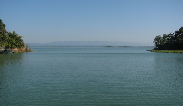
Kaptai Lake is a beautiful blue man-made watery lake. The size of this Lake is approximately 11000 square kilometer, which was created as a reservoir when the Kaptai dam was built during the 1960. This amazing Lake was created by flooding valleys and plain lands between numerous hills all around the Lake. Kaptai has Bangladesh’s only hydro-electric project. The Kaptai Dam on the Karnaphuli River created for this purpose resulted in the Kaptai Lake. This created a charming view as forested hills and plateaus rise from beneath the beautiful Lake water.
A stretch of road connects the tourist spots of Rangamati and Kaptai. The road goes deep into the hill tracts and displays the natural beauty and wildlife of the district Rangamati. The government of Bangladesh run Tourism Corporation and many private operators offer Kaptai Lake Cruise Tours, which is worth of it. Other scenic spots are also accessible through the waterways. Cruising on the Kaptai Lake is an enjoyable way of observing the landscape as many great picnic spots, natural landmarks and historic monuments are accessible only by boats.
How to go
Kaptai Lake is located in Rangamati Sadar Upazila. After reaching at Rangamati, take local transport to visit this lake.
How To Reach: Rangamati District
1. Shamoli Paribahan: From Dhaka,
Sayedabad counter, Contact: 02 -7541019
Arambag counter, Contact: 02-7193910
Fakirpul counter, Contact: 02-933364
Bus starts at 9:30 am.
2. S Alam Paribahan: From Dhaka,
Fakirpul counter, Contact: 02-9331864
Bus starts at 8am and 10.15 am.
3. Hanif Paribahan: From Dhaka,
Gabtoli counter, Contact: 01190-806447
Sayedabad counter, Contact: 01191-125048
Starting time: 8:30 am
Where to Stay
Some of the hotels/motels in Rangamati are listed below for your assistance.
1. Hotel Golden Hill
Address: Reserve Bazar Rangamati
Contact: 01820 304714
2. Hotel Green Castle
Address: Reserve Bazar Rangamati
Contact: 61200
3. Hotel Lake View
Address: Reserve Bazar Rangamati
Contact: 62063
4. Hotel Sufia
Address:Kathaltoli Rangamati
Contact: 62145
5. Peda Ting Ting
Contact: 62082


