Array
(
[0] => Array
(
[name] => {:en}Sangu River{:}{:bn}সাঙ্গু নদী{:}
[post_id] => 5349
[post_link] => http://offroadbangladesh.com/places/sangu-river/
[thumb_link] => http://offroadbangladesh.com/wp-content/uploads/2015/03/2Sangu-river1-300x200.jpg
[post_content] => {:en}
The Sangu River is a river in Myanmar and Bangladesh. Its source is in the North Arakan Hills of Myanmar, located at 21°13´N 92°37´E. The Arakan Hills form the boundary between Arakan and the Chittagong Hill Tracts. It follows a northerly circuitous course in the hill tracts and then enters Bangladesh near Remarki, Thanchi Upazila, Bandarban District, from the east. It flows north through Thanchi, Rowangchhari and Bandarban Sadar Upazilas of Bandarban District. It then flows west through Satkania and Banshkhali Upazilas in Chittagong District and flows into the Bay of Bengal near Chittagong, at 22°6´N 91°51´E, or about 16.09 kilometres (10.00 mi) south of the mouth of the Karnafuli River. The length of the river is 270 kilometres (170 mi); 173 kilometres (107 mi) are located within Bangladesh.
Sangu River is the complete part of the natural beauty of Bandarban. It follows a northerly circuitous course in the hill tracts up to Bandarban. It enters the district from the east and flows west across the district and finally falls into the Bay of Bengal at the end of a course of 270 km. This river is flowing through the hills thousands of years. It is an important route to communicate with Ruma and Thanchi Upazila. It has huge financial interests for the population of Bandarban. This river is widely used for transportation, agricultural and other necessary products for the people of remote community.
In the winter season the current of the river almost becomes stagnant but in the rainy season the current becomes aggressive. Visitor must be attract with the beautification scattered on the both sides of it. You can find here hills, forests, falls with a river together. All the way you will be thrilled only and it is simply amazing.
The major tributaries of the river are the Chand Khali Nadi and Dolukhal. The Chand Khali Nadi flows through the Patiya Plains, and the Dolukhal River drains into the Satkania Plains. Another tributary is the Kumira Khali, which drains into the Kutubdia Channel. There are seven Bangladesh Water Management Board hydrometric stations on this river, which have been recording data since 1965.
The Sangu drains off the waters of Patiya, Satkania, and Banshkhali Upazilas. It has a connection with the Karnafuli River through the Chand Khali River. The Sangu is a shallow river, but it becomes violent during rains and develops rapid currents. It is navigable up to 48.27 kilometres (29.99 mi) from the estuary. The Sangu gas field is located about 50 kilometres (31 mi) southwest of Chittagong and reaches a depth of 10 meters at its mouth.
{:}{:bn}
বান্দরবানের প্রাকৃতিক সৌন্দর্যের অন্যতম অংশ সাঙ্গু নদী পার্বত্য চট্রগ্রামে উত্তরদিকে বৃত্তাকারে বান্দরবান পর্যন্ত প্রবাহিত হয়েছে। পূর্বদিক দিয়ে বান্দরবানে প্রবেশ করে নদীটি জেলার পশ্চিম দিক দিয়ে বের হয়েছে এবং প্রায় ২৭০ কিলোমিটার প্রবাহিত হওয়ার পর বঙ্গোপসাগরে মিলিত হয়েছে। পার্বত্য অঞ্চলে হাজার বছর ধরে প্রবাহিত এই নদীটি রুমা এবং থানচি উপজেলার সাথে যোগাযোগের এক গুরুত্বপূর্ণ মাধ্যম। বান্দরবানের জনগনের অর্থনৈতিক প্রবৃদ্ধিতে এই নদীটি গুরুত্বপূর্ণ ভুমিকা পালন করছে। দুর্গম এই অঞ্চলের মানুষেরা পরিবহন, কৃষি এবং অন্যান্য প্রয়োজনীয় কাজে নদীটিকে বহুভাবে ব্যবহার করে থাকে।
শীতকালে সাঙ্গুনদীর স্রোত অনেকাংশে ম্রিয়মাণ হয়ে গেলেও বর্ষাকালে নদীটির স্রোত তীব্র আকার ধারন করে। সাঙ্গু নদীর দুই তীরের পাহাড়, বন, নদী ও ঝর্ণার সৌন্দর্যে যেকোনো পর্যটকই বিমোহিত হবেন। এক কথায় সাঙ্গুনদী দেখে আপনি শুধু অবাকই হবেন না বরং মুগ্ধতা আপনাকে গ্রাস করবে।
{:}
)
[1] => Array
(
[name] => Brahmaputra river
[post_id] => 22002
[post_link] => http://offroadbangladesh.com/places/brahmaputra-river/
[thumb_link] => http://offroadbangladesh.com/wp-content/uploads/2015/10/Brahmaputra-River-6-300x169.jpg
[post_content] =>
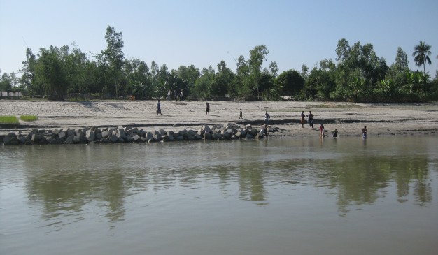
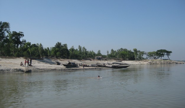
In Bangladesh, the Brahmaputra (ব্রহ্মপুত্র) river is joined by the Teesta (তিস্তা) river (or Tista), one of its largest tributaries. Below the Tista, the Brahmaputra splits into two distributary branches. The western branch, which contains the majority of the river's flow, continues due south as the Jamuna to merge with the lower Ganges called as Padma river. The eastern branch formerly the larger, but now much smaller is called the lower or old Brahmaputra.
Mymensingh (ময়মনসিংহ) district stands just beside the old Brahmaputra river. It curves southeast to join the Meghna River near Dhaka. The Padma and Meghna converge near Chandpur and flow out into the Bay of Bengal. This final part of the river is called Meghna.
The Brahmaputra enters the plains of Bangladesh after turning south around the Garo Hills below Dhuburi, India. After flowing past Chilmari, Bangladesh, it is joined on its right bank by the Tista river and then follows a 150 miles (240km) course due south as the Jamuna river. South of Gaibandha, the Old Brahmaputra leaves the left bank of the main stream and flows past Jamalpur and Mymensingh to join the Meghna river at Bhairab Bazar.
There are lot of bridges over this river at several districts. Near the Mymensingh town, you'll find two bridges. One is for the road transports, and other one is only for railway service. From one bridge other one can be seen and a traveler can enjoy the whole view of river while walking through a passage just beside the river.
)
[2] => Array
(
[name] => {:en}Tamabil{:}{:bn}তামাবিল{:}
[post_id] => 4164
[post_link] => http://offroadbangladesh.com/places/tamabil/
[thumb_link] => http://offroadbangladesh.com/wp-content/uploads/2015/03/Tamabil-provald1-300x201.jpg
[post_content] => {:en}
Tamabil is on the border front of Sylhet-Shillong road, Tamabil is surrounded by beautiful nature. It is about 55 km away from Sylhet town. The sight of mountains while traveling through the zigzag streets is an attraction for the tourists. The tide flowing from the mountains is a treat to watch for the eyes.
[This spot needs more detail. If you have more information and photos, please be advised to add in our website. Your name will be published as a Content Contributor]
{:}{:bn}
চমৎকার প্রাকৃতিক সৌন্দর্যে আচ্ছাদিত তামাবিল হল সিলেট-শিলং সড়কের বাংলাদেশ অংশে অবস্থিত সীমান্ত এলাকা। সিলেট থেকে ৫৫ কিলোমিটার দূরে অবস্থিত তামাবিলে যাবার সময় অন্যতম আকর্ষণ হল আঁকাবাঁকা বিশাল পাহাড় দেখতে পাওয়া। পাহাড়ের মধ্যে দিয়ে ঝর্নার প্রবাহ দেখে আপনার দৃষ্টি জুড়িয়ে যাবে তাতে কোনই সন্দেহ নেই।
{:}
)
[3] => Array
(
[name] => River Dhepa
[post_id] => 7575
[post_link] => http://offroadbangladesh.com/places/river-dhepa/
[thumb_link] => http://offroadbangladesh.com/wp-content/uploads/2015/04/River-Dhepa1-300x240.jpg
[post_content] =>
River Dhepa is in north Bengal; more precisely it is near to the famous "Kantaji Temple" of Dinajpur. River Dhepa is originated from the river Atrai, and then it falls at the river Punarbhaba. This is a shallow river, and the average depth of the river was around 2-4 feet. The length of the river is around 40 kilometer.
The river is itself beautiful. The two banks of the river make it more beautiful due to the various kinds of crops fields. Main crop field is corn, but there are others like paddy, and some vegetable fields.
The water of the river is not muddy, it’s clear. Due to the shallowness of the river, you can easily see the bottom of the river easily. Also there are some very small mound of soil is visible throughout the whole river. Some mound contains green plants.
Another beauty of the river is, the nest of the bird "Kingfisher" at the bank of the river. There are some places where the banks are too high. At the soil, the kingfisher birds made their nest. It’s a lovely scene. They are not only gorgeous to see, but also exciting when they are about to catch a fish from the water.
)
)