মধুমতি নদী
Type: নদী
Contributed By: Nayeem


Brief
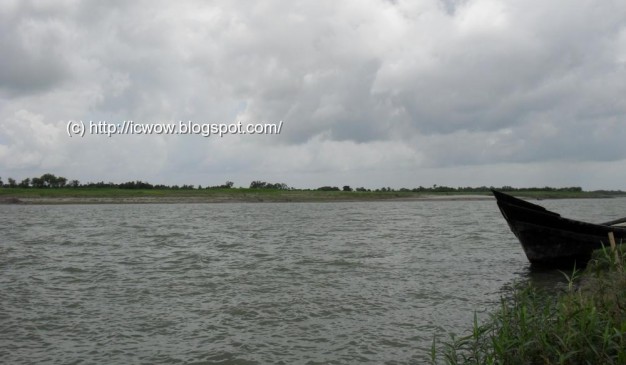
একাধিক জেলা দিয়ে প্রবাহিত বাংলাদেশের চমৎকার এই নদীটির পানির রঙ সবুজ। বাংলাদেশের অন্যতম ছোট জেলা মাগুরা দিয়েও এই নদীটি প্রবাহিত হয়েছে। মধুমতি নদীটি বাংলাদেশের অন্যান্য নদীগুলোর মতো কারন বর্ষা মৌসুমের শুরুতে এই নদীটি যথেষ্ট প্রসারিত থাকে যা কিনা বর্ষা মৌসুমের শেষে আরও বেড়ে যায়। নদীর একপাড় থেকে অন্য পাড়ে মানুষকে পাড় করার জন্যে একটি খেয়া ঘাট আছে। এই নদীতে ট্রলারের মত ভারি নৌযান চলাচল না করায় নদীটির পানি তেল দিয়ে দুষিত হয়নি।
অন্যান্য নদীর তীরের চেয়ে এই নদীর তীরে অবস্থিত রাস্তাটি বেশ উঁচু। এছাড়া এখানে অবস্থিত একটি বটগাছ আছে যেটির ছায়াতলে ক্লান্ত পথিক, রিকশাচালকরা বিশ্রাম নিয়ে থাকেন।
How to go
ঢাকার গাবতলি বাসস্ট্যান্ড থেকে বিভিন্ন বাস সার্ভিস ফরিদপুরের উদ্দেশ্যে চলাচল করে থাকে। এসব বাস সার্ভিসের মধ্যে রয়েছেঃ আজমেরি এণ্টারপ্রাইজ, আনন্দ পরিবহন, সূর্যমুখী পরিবহন ইত্যাদি। এসব বাসে ভ্রমন করতে কমবেশি ১৪০/- টাকা থেকে ১৫০/- টাকা পর্যন্ত ভাড়া দিতে হবে আপনাকে। তবে আজমেরি এণ্টারপ্রাইজে ভ্রমন করলে আপনাকে লঞ্চে করে পদ্মা নদী পার হতে হবে যার মানে হল নদীর ওপারে গিয়ে আপনাকে বাস বদলাতে হবে।
ফরিদপুরে পৌঁছে আপনি মোটরসাইকেল ভাড়া করে বোয়ালমারি থানায় আসতে পারবেন। নোয়াপাড়া গ্রাম অতিক্রম করে কয়েক কিলোমিটার যাবার পরই আপনার চোখে পড়বে রাস্তার পাশ দিয়ে বহমান মধুমতি নদীকে।
How To Reach: ফরিদপুর জেলা
It would take around 3 hours and 52 minutes to travel Faridpur from Dhaka city via Tongi and Baipayl (বাইপাইল) through crossing the river. The distance is around 138.1 km. Air distance from Dhaka to Faridpur is 56 km.
1. Nabil Paribahan
Address: 15/1, old Gabtoly Mirpur, Dhaka-1218
Phone: 02-9007036, 02-9011143
2. Goldenline & Azmiri Enterprise ( AC Bus Service, Faridpur>Dhaka)
Tel : 0631-66988,
Cell: 01755-522 200, 01733-208 87
3. Zaker Enterprise ( NON AC Bus , Faridpur> Dhaka)
Tel: 01712- 424 134
4. Saudia Paribahan ( Faridpur>Dhaka)
Tel : 0631-63644
Cell: 01916-136 531, 01717-605 576
Where to Stay
1. Hotel Raffell Inn
Gowalchamot (গোয়ালচামট), Faridpur
32 rooms, Non-governmental,
Phone: 0631-61106
2. Hotel Laxury, Resident
Gowalchamot (গোয়ালচামট), Faridpur
65 rooms, Non-governmental,
Phone: 0631-62623
3. Hotel Padma, Resident
Mujib Road, Faridpur
45 rooms, Non-governmental,
Phone: 0631-62685
4. Hotel Park Palace, Resident
38 rooms, Non-governmental,
Phone: 01556327067
5. Hotel Shyamoli, Resident
Mujib Road, Faridpur
13 rooms, Non-governmental,
Phone: 0631-64538
6. Hotel jonaki, Resident
Gowalchamot (গোয়ালচামট), Faridpur
44 rooms, Non-governmental,
Phone: 0631-64168
7. Regional Rice Research Institute, Guest House
Chief Scientific Officer, Regional Rice Research Institute,
Vanga (ভাঙ্গা), Faridpur
Governmental, 100/- for Non-AC
Phone: 06323-56329
8. সুকন্যা ভবন
Address: Faridpur District
9. Jui House
Faridpur – Magura – Jhenaidah – Jessore – Khulna – Mongla Road
Eating Facilities
ফরিদপুর শহরে খাওয়ার জন্য বেশকিছু ভালমানের হোটেল ও রেস্টুরেন্ট পেয়ে যাবেন। ফরিদপুর শহরে কোথায় খাবেন, জানতে এখানে ক্লিক করুন


