Array
(
[0] => Array
(
[name] => Hardinge Bridge
[post_id] => 2871
[post_link] => http://offroadbangladesh.com/places/hardinge-bridge/
[thumb_link] => http://offroadbangladesh.com/wp-content/uploads/2015/02/Hardinge-Bridge-300x146.jpg
[post_content] =>
Hardinge Bridge (Bengali:
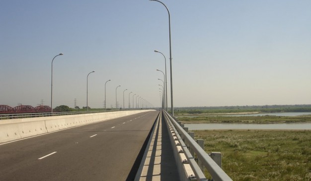
হার্ডিঞ্জ ব্রিজ) is a steel railway bridge over the river Padma located at Paksey in western Bangladesh. It is named after Lord Hardinge, who was the Viceroy of India from 1910 to 1916. The bridge is 1.8 kilometers (1.1 mi) long. It is named after Lord Hardinge. From 1910-1916 he was the Viceroy of India. Its construction began in 1910 and ended in 1912, though it was proposed two decades ago. There was train movement on it from 1915. There was proposal of constructing a railway bridge over Padma. Eastern Bengal Railway laid the proposal in 1889.The motive of constructing this bridge was to ease communication between Eastern part of Bengal and Kolkata.
The construction of a railway bridge over the Padma was proposed in 1889 by the Eastern Bengal Railway for easier communication between Calcutta and the then Eastern Bengal and Assam. In 1902, Sir FJE Spring prepared a report on the bridge. A technical committee reported that a bridge could be constructed at Sara crossing the lowerGanges between the Paksey and Bheramara Upazila stations on the broad gauge railway from Khulna to Parbatipur Upazila. The construction of the bridge started in 1910 and finished two years later. The bridge comprises 15 steel trusses. The main girders are modified "Petit" type.
The most difficult task of the operation was to prevent bank erosion and to make the river flow permanently under the bridge. For this, two guide banks of the "Bell-bund" type named after J. R. Bell were built on either side, each extending 910 metres (3,000 ft) upstream and 300 metres (1,000 ft) downstream from the bridge.
[2] The ends of the river banks were curved inward and heavily pitched with stone.
Hardinge Bridge was severely damaged during the Liberation War of Bangladesh of 1971. It happened on 13 December 1971, when the Indian Air Force plane bombed on the 4th guarder from the Paksey side. As the Pakistani army was on retreat towards Jessore (their last stronghold) Hardinge Bridge was strategically very important. The allied force damaged the bridge. The Japanese Government helped to reconstruct the bridge. It is the second largest railway bridge in Bangladesh. Another bridge named Lalon Shah Bridge for road transport beside the Hardinge Bridge has recently been constructed.
)
[1] => Array
(
[name] => Hatirpool Bridge
[post_id] => 1054
[post_link] => http://offroadbangladesh.com/places/hatirpool-bridge/
[thumb_link] => http://offroadbangladesh.com/wp-content/uploads/2015/02/Hatir-Pool-Bridge41-300x225.jpg
[post_content] =>
Hatirpool Bridge is located near Beriura Bazar at Sarail Upazila, Brahmanbaria on the way to Dhaka-Chittagong road. A road was built by Dewan Shabaz Ali from Sorail to Shabazpur during 1650 A.D. Many assume that this bridge was built at that time. Locally it is known as ‘Hatir Pool’. It is said that Dewans used to cross the river on back of elephant over this bridge.
This brick built bridge is curved in from with one big arched opening. Hatir Pool is a protected monument of Department of Archaeology, Bangladesh.
[This spot needs more detail. If you have more information and photos, please be advised to add in our website. Your name will be published as a Content Contributor]
)
[2] => Array
(
[name] => Teesta Railway Bridge
[post_id] => 6434
[post_link] => http://offroadbangladesh.com/places/teesta-railway-bridge/
[thumb_link] => http://offroadbangladesh.com/wp-content/uploads/2015/04/tista-barrage1-300x200.jpg
[post_content] =>
Teesta Railway Bridge is the third largest railway bridge of the country lengths about 2000 feet and constructed in the year 1834.
In 1978, to manage load of road vehicles for Lalmonirhat, Kurigram and beyond by ferry, the then president Ziaur Rahman instructed the Railway and Roads authority to set wooden sleepers in the rail bridge between the rails for all types of vehicular movement. Same year, March 4, President Ziaur Rahman inaugurated the bridge for vehicular movement. The bridge restores the communication from divisional headquarters of Rangpur with two districts, Lalmonirhat and Kurigram.
The bridge is now in broken-down condition and needs major repair. For motor vehicles construction of a road bridge began next to it in 2006 for completion by 2009 at a cost of Tk 1.22 billion which is now expected to be opened in June 2012.
)
[3] => Array
(
[name] => {:en}Keane Bridge{:}{:bn}কিন ব্রীজ{:}
[post_id] => 4248
[post_link] => http://offroadbangladesh.com/places/keane-bridge/
[thumb_link] => http://offroadbangladesh.com/wp-content/uploads/2015/03/3059355523_3e9b516da2_z1-300x225.jpg
[post_content] => {:en}
Keane Bridge was named after Sir Micheal Keane who was English governor of Assam from 1932-1937, located on top of Surma river and it is known as the gateway to Sylhet. It was built in the year 1936. Standing on 1150 feet tall and with a width of 18 feet, this bridge the sign of many history. The budget required to build this bridge was 5.6 million taka.
[This spot needs more detail. If you have more information and photos, please be advised to add in our website. Your name will be published as a Content Contributor]
{:}{:bn}কিন ব্রীজ সিলেট শহরে শাহজালাল সড়কের কাছে অবস্থিত। ১৯৩২ সাল থেকে ১৯৩৭ সাল পর্যন্ত আসামের ইংরেজ গভর্নর স্যার মাইকেল কিনের নামে এই সেতুটির নামকরন করা হয়। সুরমা নদীর ওপর অবস্থিত এই সেতুটি সিলেট শহরের প্রবেশদ্বার হিসেবে পরিচিত। ১৯৩৬ সালে নির্মিত এই সেতুটির দৈর্ঘ্য ১১৫০ ফুট এবং প্রস্থ ১৪ ফুট। এই সেতুটি নির্মাণে প্রায় ৫৬ লাখ টাকা ব্যায় হয়েছিল।{:}
)
)