Jadukata River and Barik Tila
Type: River
Contributed By: Nayeem ,Arifin Billah,Mr Basar


Brief
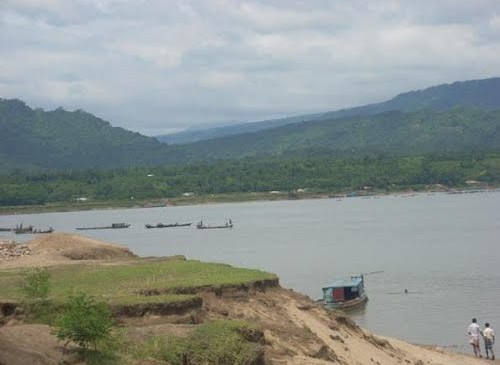
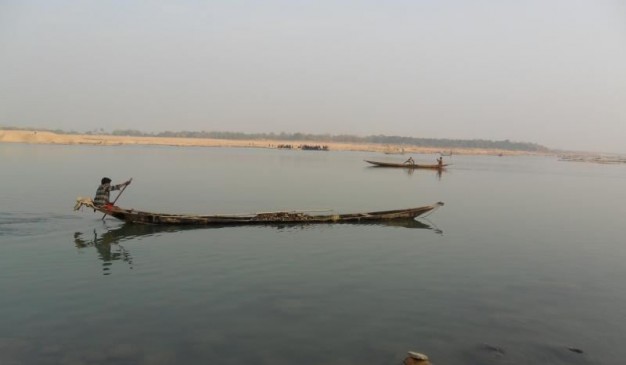
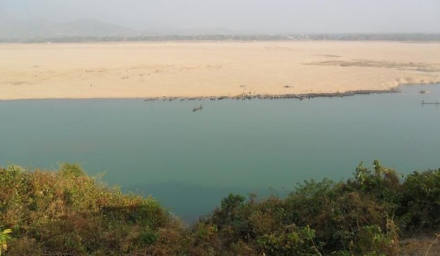
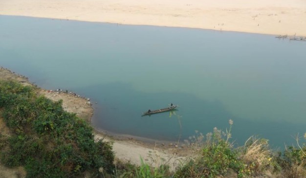
Jadukata River and Barik Tila are located in the same place. Jadukata River is another blue river at Sunamganj. Jadukata River is originated from the Meghalaya Hills of India & flows into Bangladesh. The river is very wide in the rainy season. If you visit in the winter, the mile long sandy bank will tell you about the fierceness of the river at rainy season. The color of the water is bluish. It’s very clear that you can almost see the river bed from the bank. You’ll find lot of large stones everywhere on the bank.
There is a hillock beside the river with 150 feet of height. It is said as Barik Tila or Barikka Tila by the local people. There is a pillar available at the hill which defines the border of Bangladesh and India. On top of it everything looks very small. The pillar between the hills is the border line between Bangladesh and India. You should be very careful about Indian BSF.
This river has produced lot of brunches & canals, but all of those joined with the Surma River.
How to go
You need to reach Sunamganj at the very beginning. The GPS of the Jadukata River is (25°11’27.03″N, 91°14’56.05″E). You need to hire motor bike. It is around 300 taka for two people on a bike (same from Sunamganj town). It will take 60-80 minutes to reach the beautiful river.
How To Reach: Sunamganj District
You can reach Sunamganj only by road. There is no direct rail, air or water transportation system available.
1. Hanif Enterprise:
Arambagh Counter: 01713-402671
Sayedabad Counter: 01713-402673
2. Shyamoli Paribahan:
Arambagh Counter, Dhaka. Phone-7102291, 0193626023
Sayedabad Counter, Dhaka. Phone-0171-8075541, 7511019, 7550071
3. Mamun Enterprise:
First tip – 7:30am, last tip – 12:30am (bus in every 1 hour)
Sayadabad -01718438732, Jonopath mor-0191777061, Fakirapul- 0191287467
You can also try to go there by train or air. You need to reach Sylhet first & afterwards you can ride on a local bus towards Sunamganj. It will take one hour from Sylhet. To know more about how to reach Sylhet, please visit our Sylhet district page.
Where to Stay
There are a number of hotels in the Sunamganj town. You can find hotels according to your budget over here. Few names are given below for your convenience:
1. Hotel Nader Riaz
Address: Thana Road, Derai.
Phone: 01712715916
2. Zila Parshad Dak Bungalow
Manager: Upazila Executive Officer
Address: Sadar Upazila, Derai
Phone: 01911534466
3. Surmavally Residential Resort
Address: Sunamganj Sadar
Contact: Nazir Hussain
Mob:01711438803
Phone :008828913956
fax no:0088-2-9880615
email: surmavally@hotmail.com
4. Hotel Ali Brothers
Manager/Owner: Hazi Muhammad Ambor Ali
Address: Derai college road, Derai
Phone: 01724112036
Things to do
- Stand on top of the Tila and enjoy the view of river.
- Take a boat ride.
- Take some pictures.
Eating Facilities
There are not much eating facilities despite some shops where a bit of snacks, juice are found. It’s better to carry food if someone wants to go there.


