Lalon Shah Bridge
Type: Bridge
Contributed By: Nayeem ,Doeita,Mahmudur Rahman Khan,Rifat Hasan Rony,Sadi Khan,Shameem Bakhshi,Shohel Sikder


Brief
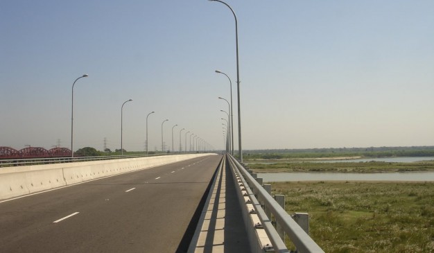
Lalon Shah Bridge (Bengali: লালন শাহ সেতু), also known as the Paksey Bridge, is a road bridge in Bangladesh over the river Padma, situated between Ishwardi Upazila of Pabna on the east, and Bheramara Upazila of Kushtia on the west. Named after early 19th century mystic poet Lalon Shah of Chhewuriya, Kushtia District, the bridge was completed in 2004.
The bridge is 1,800 metres (5,900 ft) long and is the fourth longest road bridge of the country, after Jamuna Bridge, Meghna Bridge and Meghna-Gomti bridge. It provides important road connection to Mongla port of Khulna District in the south from Rajshahi division and Rangpur division, the northern part of Bangladesh. It is situated parallel to and south (downstream) of Hardinge Bridge.
How to go
It is located in between Iswardi Upazila of Pabna on the east and Bhremana Upazila of Kushtia on the east, parallel to Hardinge Bridge. Referred how to reach Pabna/Iswardi from Dhaka. For direction to Lalon Shah Bridge see http://bit.ly/1lKx20D
How To Reach: Kushtia District
You can travel to Kushtia from Dhaka by bus. Some of the bus services have been listed below for your assistance:
1. SB Super Deluxe
Gabtoli Counter, Phone: 02-9000627
Fare: TK 600 (AC), TK 450 (Non AC)
2. Shyamoli Paribahan
Gabtoli counter, Phone: 01711-987 028
Where to Stay
There are some hotels in the district where you may consider staying in. Some of them have been listed below for your assistance:
1. Azmiree hotel
Contact: 071-53012
2. Desha Guest house
Contact: 01720510212
3. Hotel Al-Amin
Contact: 071-54193
4. Hotel Gold Star
Contact: 071-61675
5. Hotel River view
Contact: 071-71660
Eating Facilities
Enjoy the exotic view of river on top of the bridge. Or you can take pictures.


